Frais de port offerts : dès 19€ en Locker Mondial Relay et 29€ en Colissimo (France Métropolitaine)
Frais de port offerts : dès 19€ en Locker Mondial Relay et 29€ en Colissimo (France Métropolitaine)

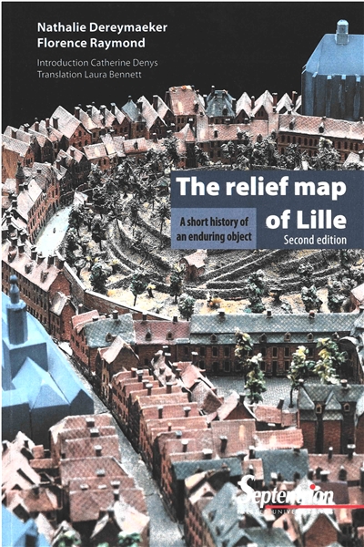
A short history of an enduring object
The relief map of Lille
Second edition
The relief map of Lille is part of the French collection of models of fortified towns and cities that began under Louis XIV and continued until Napoleon III. The object has had a turbulent history since it was made in Lille in 1743.
A veritable time machine, the relief map is a mine of priceless information about the 18th-century city and the meticulousness with which it represents the urban landscapes charms all those who see it.
Thanks to painstaking restoration work, the 14 relief maps deposited by the French state at the Palais des Beaux-Arts have rediscovered their freshness in a specially designed gallery. The map of Lille has been digitised and new exhibition technology now makes it easier for visitors to understand.
Auteur :
Dereymaeker, Nathalie
Raymond, Florence
Date de parution : 26/09/2019
Éditeur : Presses universitaires du Septentrion
Classification : Architecture, urbanisme



(France Métropolitaine)

07400 Le Teil (Ardèche)

Carte bancaire

06 70 63 29 00